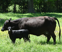
The NRI program collects and produces scientifically credible information on the status, condition, and trends of land, soil, water, and related resources in support of efforts to protect, restore, and enhance the lands and waters of the United States. About 2,500 unique locations are required to be surveyed annually to determine the effects of grazing land management on the environment.
NRCS is seeking the assistance of Texas landowners to help with this years survey. By allowing access to your land, you are helping demonstrate the valuable contributions made by Americas farmers and ranchers to the environment. Your cooperation can help improve conservation programs for Americas working lands. And the information we collect will also help set the foundation for a new generation of conservation practices to support improved grazing lands.
Onsite data collection is necessary to obtain data that cannot be obtained or monitored in other ways. NRCS grassland specialists and other conservation specialists visit the sample site to observe resource conditions and make measurements of vegetation. Sampling takes only a few hours. The data collectors use handheld equipment to locate the collection site and record observed natural resource information. These activities do not disturb the landscape and are similar to the activities used in normal NRCS conservation planning efforts. Without the permission of private landowners, the data cannot be collected.
The study sites for this survey are selected at random to represent much larger acreages of grazing land. Expansion factors applied to each survey site allow NRCS to estimate conditions on rangeland and pastureland across the nation. NRCS will also use the data to assist in allocating Farm Bill program resources.
While participation in this program is voluntary, as are all programs with the USDA, the NRI program is a valuable tool that plays a key role in directing agricultural conservation efforts by helping us better understand the condition and trend of our natural resources. Local field office staff or an NRCS NRI specialist will contact landowners with study site locations on their property by mail, phone or email to obtain permission.
Confidentiality
NRCS does not link the data gathered to the landowners name or other personal information. NRCS will not provide your name, ownership information, or other personal information to any other Federal, State, local, or private agency or organization.
For further information visit http://www.nrcs.usda.gov/nri or contact NRCS Texas State Resources Inventory Coordinator Corylee M. Thomas at corylee.thomas@usda.gov or (254)-742-9863.
More Information
To learn more about NRCS programs, producers can contact their local USDA Service Center. Producers can also apply for NRCS programs, manage conservation plans and contracts, and view and print conservation maps by logging into their farmers.gov account. If you dont have an account, sign up today.
For 90 years, NRCS has helped farmers, ranchers and forestland owners make investments in their operations and local communities to improve the quality of our air, water, soil, and wildlife habitat. NRCS uses the latest science and technology to help keep working lands working, boost agricultural economies, and increase the competitiveness of American agriculture. NRCS provides one-on-one, personalized advice and financial assistance and works with producers to help them reach their goals through voluntary, incentive-based conservation programs. For more information, visit nrcs.usda.gov.