Editor's note: This article was originally published March 11, 2011, but with all the work going on at the future site of Lake Ralph Hall, this seemed like a good time to run it again.
Fannin County, Texas -- The first pioneer settlers arrived in what is now Bonham, Texas in 1836 and today's residents are justifiably proud to live in one of the first towns established by Anglo settlers in Texas.
But drop off into the North Sulphur River valley near Ladonia, Texas and time operates on a completely different scale.
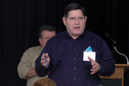
The people attending a U.S. Army Corps of Engineers information exchange meeting in Ladonia last year heard a veteran archeologist say that evidence shows the earliest visitors began arriving in the river valley north of Ladonia 10,000 to 15,000 years ago.
Amazingly enough, archeologist S. Alan Skinner, Ph.D, believes the one thing that first attracted people to the Sulphur River bottom may have also been the one thing that fascinated the region's first pioneer settlers. (Hint: it was the original name for Bonham)
"It is my belief they came here for the purpose of harvesting bois d'arc wood to use and trade," Dr. Skinner surmises.
Skinner's timetable has these early residents arriving 2,000 years before Caddo Indians. It is interesting to note that his scenario would indicate that the unique properties of the remarkable bois d'arc tree were understood and appreciated thousands of years before weapon technology produced the first bows and arrows. This durable wood was a favorite for tomahawk handles and war clubs, a medicinal tea was made from the root and the yellow outer layer of the root and yellow inner bark produced a yellow dye. From the rough outer bark came fibers for rope as well as tannin used to process leather.
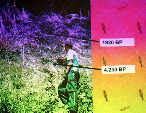
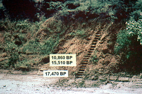
Evidence unearthed by the Corps points to a much more dynamic river that flowed year round. At one prehistoric encampment along the river dated between 1,920 and 4,250 years old, tens of thousands of freshwater clams had been harvested.
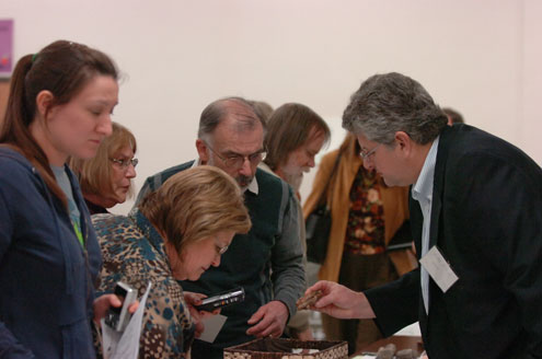
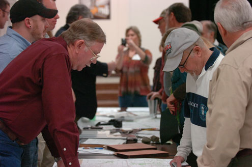
The purpose of the meeting was to educate the public about the role the Corps has been performing, and will continue to do, concerning a careful evaluation of the prehistoric, historic and paleontology resources likely to be affected by the construction of Lake Ralph Hall.
The Corps was actively soliciting information from the public in regard to prehistoric, historic and paleontology resources that should be considered during this decision-making process.
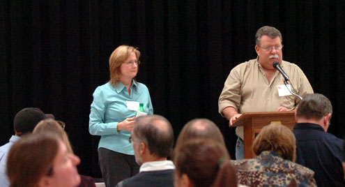
"Our role is to objectively evaluate this project," remarked Jennifer Walker of the U.S. Army Corps of Engineers Chief Permits Section. "We are interested in getting a full spectrum of public comments."
After thoroughly studying the proposal by Upper Trinity Regional Water District to build Lake Ralph Hall north of Ladonia on the Sulphur River, Walker says the Corps of Engineers will most likely do one of three things: they can issue the permit, deny the permit, or issue the permit with special restrictions.
An example of an historic site certain to be affected by the proposed lake would be the abandoned railroad watering stop known as Bagby that was used by the Gulf, Colorado and Santa Fe Railroad from 1895 until 1939. Pilings can still be found where the railroad bridge once spanned the North Sulphur River. One reason the railroad ceased operations is also one reason this site is being studied for a proposed reservoir: erosion.
In an effort to improve water flow during heavy runoff and curtail erosion, a 20-foot wide, 10-foot deep river channel was dug in the 1930s. No doubt water flow drastically improved, but erosion accelerated, eventually collapsing the railroad bridge. That 20-foot wide channel is now well over 200-feet wide in places.
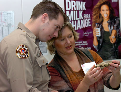
While everyone may not be familiar with the history of Bagby, it is common knowledge this area is a treasure trove of prehistoric artifacts that range from spear points that date back over 10,000 years to arrowheads that first came on the scene 1,200 years ago.
But, surprisingly enough, the Corps found far more prehistoric campsites when they surveyed for Cooper Lake. There is a good reason for that, though. According to radiocarbon dating tests done by the Corps, sediments began to be deposited in the upper North Sulphur River valley a little more than 17,000 years ago.
At the time of the Corps of Engineers meeting, about 20 archeological sites had been recorded where Lake Ralph Hall may one day be located.
"We think more needs to be looked at...no question," Skinner stated.
He expects more finds, possibly even significant sites, between now and the preconstruction examination. However, because of the way soil has slowly filled the valley, many of the oldest campsites are now buried 10 feet or even deeper below the surface. Some will be lost forever if the proposed lake is built, but Skinner indicated the Corps is willing to use a track hoe to excavate high-priority sites.
And all the Corps representatives seemed to be satisfied with the cooperation they have been receiving from Upper Trinity Regional Water District.
"They [UTRWD] have been very helpful and very supportive," remarked Corps archeologist Skipper Scott. "We're very appreciative of that."
Actually, the layers of soil that secreted away fascinating artifacts are also the reason this area supplies a steady stream of interesting finds by both amateurs and professionals.
As the river bank and the valley's many feeder creeks erode, archeology is at first exposed and then eventually it tumbles down into the river channel.
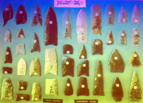
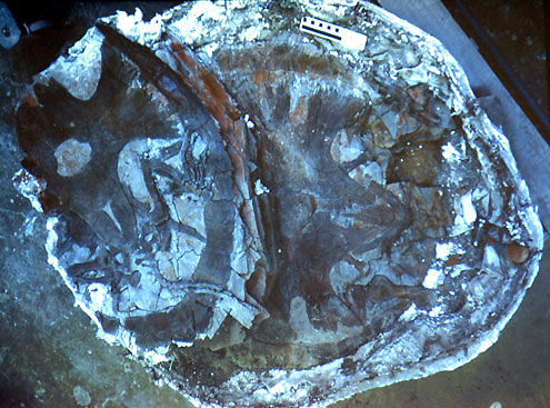
While a 10,000-year-old spear point is a remarkable find, compare that to a mammoth molar from the Pliocene epoch from around 4.8 million years ago until the last glacial retreat 20,000 years ago. Still, all of that is like last week on the calendar compared to some of the finds that were brought to the Corps meeting January 21. One amateur fossil hunter came in with a fossilized fish found in a tributary to North Sulphur River that was estimated to be approximately 79-80 million years old.
SMU Paleontologist Mike Polcyn told how present-day continents took shape during the Cretaceous Period 145 million to 65 million years ago. High latitude warming meant there were no ice caps. Marine reptiles such as mosasaurs flourished, in part due to a dramatic rise in water temperature. Elevated sea levels created a shallow sea that covered much of the middle of North America.
The Glen Rose Formation was along the shoreline of this sea and some of the finest preserved dinosaur footprints anywhere in the world attract thousands of visitors each year to Dinosaur Valley State Park just north of Glen Rose. Farther south, the Austin Shale Formation encases an abundance of fossils such as ammonites and inoceremus.
In Alabama, the Eutaw Formation regularly produces dinosaur, mosasaur and pterosaur remains.
To our north, vertebrate fossils from the Blanco Formation in Kansas have been studied for over a century.
Situated in the middle of these significant formations is the North Sulphur River Valley, an area that has attracted amateur and professional paleontologists for decades.
As someone who has walked these creeks and the North Sulphur River bed for 20 years, Mr. Polcyn understands why so many people are convinced that building a lake in a fossil-rich region such as the upper North Sulphur River Valley would be a travesty. Polcyn knows that Cretaceous Period fossils produced in this area have helped scientists better understand what was happening in the rest of the world during a dynamic period of the earth's history.
But he also feels there are two sides to this issue.
"You have a trade-off," Polcyn said as he contemplated how a lake would alter this popular site for arrowhead hunters and fossil collectors. "Flash floods, while exposing paleontology, tend to scatter evidence. Slower erosion should mean more complete material to study."