Even from several miles away, it’s a landscape feature that you know doesn’t belong. What is mostly a flat grassland plain with an occasional undulation, north eastern New Mexico is an iconic representation of the American Great Plains.
Along US Highway 87 between Clayton and Raton, the antelope outnumber people in this part of the state. Leaving Clayton and heading west, vast stretches of grasslands provide an unabated view across the horizontal yellow plains and ends abruptly where the enormous cobalt sky begins. Headed towards the Rocky Mountains, small, conically symmetrical mountains begin to curiously appear. Disconnected the mounds represents the remnants of extinct volcanoes whose eruption forever transformed the local landscape.
All the volcanoes are on private land except for one. Capulin Mountain is so special and such a prime example of an extinct and oddly symmetrical cinder cone volcano, the United States Congress deemed it a national monument in 1916.
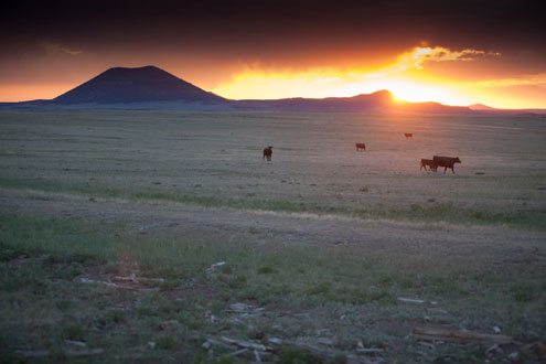
photo by Russell Graves
At the base of the volcano, a visitors center explains, in clear detail, how the surrounding ecosystems were formed by fire and cinder and how time transformed the mountain and surrounding plains into a niche ecosystem that’s full of plants and animals that flourish in the rich, volcanic soil.
Spiraling up the mountain, a road takes you around and around the dried lava and progressively up the mountain. While the view is spectacular, the road is narrow and I keep my eyes on the pavement as we creep to the top of the peak that rises 8,182 feet above sea level.
At the top, a parking area overlooks the broad crater from which the lava once exploded. The rim of the crater is about a mile in circumference and has a walking trail that circumnavigates the opening in the mountain top. To the east, you can see where huge beds of lava flowed out from the base of the volcano and dried in an unusual fashion that looks like black, frozen water. To the north and west, more volcanos are seen in the distance while the Sangre de Cristo Mountains stand well in the distance.
There is also a trail that heads downhill into the crater. The trail passes lava fields that turned to stone after the lava cooled some 60,000 years ago when this volcanic region was active. Now, vegetation hangs in precarious spots where seeds found a hospitable medium in the lava in which to root. At the bottom of the crater, a small area is roped off where the main lava vent once spewed tons of volcanic rock and ash across the countryside.
The mountain is a geologic wonder and it’s definitely worth the stop.
Any questions or comments? Contact Russell at russell@russellgraves.com or visit his website at www.russellgraves.com